
Oakley ZIP Code Coverage
Research identifies 94561 as Oakley’s overwhelmingly principal standard ZIP. Its delivery area covers incorporated Oakley and can extend around community and Delta-edge addresses. The postal code is a delivery key, not a city-limit line. The Oakley ZIP code directory therefore needs a single confirmed row plus a note about the boundary check rather than a padded list of nearby codes.
| ZIP | Areas Covered | Post Office | Notes |
|---|---|---|---|
| 94561 | Incorporated Oakley and the surrounding postal delivery area described by USPS | Oakley Post Office; verify current facility details in USPS | Principal standard ZIP; not coterminous with city limits |
No official source in the research identified a separate Oakley PO-box-only or unique ZIP, a dated split, or neighborhood-by-neighborhood postal lines. Nearby communities should not be added to the Oakley ZIP directory merely because they sit close by.
Verify Oakley ZIP Code Addresses
The USPS city and state ZIP lookup is the authority for mailing normalization. USPS also publishes ZIP guidance for address searches. Enter the street, city, and state when testing an address, then keep the returned ZIP with the exact street line. The captured USPS form is useful because it puts the postal question before the government-boundary question.
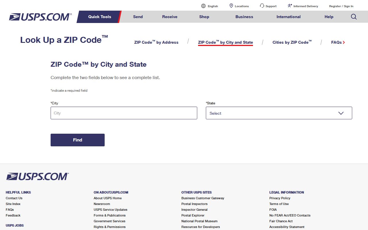
After USPS confirms the mailing line, compare the same address with Oakley’s City General Viewer and Contra Costa parcel tools. The ZIP result tells where mail routes; the city and county maps tell which government owns the parcel record.
Oakley Post Office is listed at 400 Del Antico Avenue, Oakley, CA 94561-5710, with phone 925-625-5687. Retail hours are Monday through Friday 9 to 5 and Saturday 9:30 to 12:30; bulk acceptance is Monday through Friday 9:30 to 2. Verify current hours and services in USPS before visiting.
Find Oakley Residents by ZIP Code
A ZIP code can narrow a resident-directory question, but the county assessor does not offer a broad ZIP filter that returns all people in 94561. Build the area through postal and map checks, then move to an address, APN, name, or record type. That keeps an Oakley ZIP directory from implying that a postal list is a household roll.
- Verify the full mailing address and ZIP with USPS, including the city and state wording.
- Check Oakley’s City General Viewer for city limits, parcels, council districts, land use, zoning, and street layers.
- Use CCMAP or ParcelQuest Lite to identify the APN and parcel facts for the exact address.
- Choose the next custodian: Assessor for lawful ownership data, Clerk-Recorder for deeds, City Hall for permits, or a library for history.
- Use a name or address search only after the ZIP has narrowed the correct place, and record the source and date of each result.
For street-level work after the ZIP is confirmed, the Oakley street directory follows the APN and address chain.
ZIP Codes Versus Oakley City Limits
ZIP routing does not define incorporation, school attendance, taxing jurisdiction, police responsibility, or a service district. A 94561 Oakley mailing address can sit outside incorporated limits, while a parcel near a boundary needs a map check instead of an assumption based on postal city. The Oakley postal directory answers a delivery question; the city viewer answers a corporate-boundary question.
Oakley’s General Viewer and maps page lists City Limits, Parcels, Council Districts, General Plan Land Use, Zoning, and Street Sweeping layers. The captured city-map view represents the second step after USPS normalization.
Use the city layer for incorporation, CCMAP for parcel geometry, and the relevant district office for a service question. None of those geographies substitutes for USPS.
- ZIP code
- A USPS delivery area used to route mail.
- ZCTA
- A Census statistical approximation that may not match a postal route or city limit.
- ZIP+4
- A more detailed delivery add-on that does not create a new government boundary.
- PO-box-only ZIP
- A postal code used mainly for box delivery; no separate Oakley example was verified in the research.
- Unique ZIP
- A code assigned to one organization or address; no Oakley unique code was identified.
- Carrier route
- A delivery path inside a postal area, not a parcel, city, or resident record.
- APN
- The county parcel key that stabilizes property research after the address is verified.
These terms explain why a postal result should not be stretched. A ZIP+4 or carrier route can refine delivery, while a PO-box-only or unique code would describe a postal arrangement rather than a city boundary. The research found no official Oakley split, unique code, or PO-box-only row to add. Verify the exact address first, then record only the postal detail that USPS returns.
One Oakley ZIP, Many Development Eras
94561 covers an Oakley built in layers. Downtown and older streets carry the town’s early railroad and agricultural history. Later growth brought subdivision plats, county permits, assessment changes, and newer city records. Census and newspaper clues may be more useful for an older block, while parcel, permit, and map records become more useful for a later subdivision.
Oakley’s four historic hamlets, Live Oak, Oakley, Iron House, and El Rancho, can also appear inside a modern 94561 search. Add those terms when reading historical directories, census schedules, newspapers, or family files. The place label is a search aid, not a reason to change the confirmed street or parcel.
The 1898 ten-block plat used Main, Acme, Ruby, Star, and Home crossed by First, Second, and Third. The MARSH acrostic and the older Highway 4 alignment now associated with Main Street can help explain a historic address that does not look modern.
Why Oakley Parcel Search Skips ZIPs
Contra Costa property tools key land by APN and situs address, not by a postal directory. ParcelQuest Lite accepts APN or street address. CCMAP can show parcel geometry, aerial context, contours, radius selection, and assessor map PDFs. Neither makes the ZIP a people-search field, and owner names remain suppressed online.
Use the ZIP to normalize the address, then use the APN as the property key. A county public counter or proper request is the path for owner information. The Clerk-Recorder keys deeds by grantor, grantee, document, and legal description. The Treasurer-Tax Collector keys tax data by APN or situs. Those different keys are why a ZIP-only search cannot safely merge the records.
Current tax data is updated at least weekly, according to the research, but a tax bill still shows a parcel and payment status rather than a resident list. Property, deed, tax, and household questions need separate source labels.
Oakley ZIP Records: Situs and Legal Keys
Three address systems meet in an Oakley ZIP code directory. USPS uses a delivery line. The Assessor uses a situs and APN. The Recorder uses a legal description and document index. A mailing address can differ from the physical parcel. A legal description can remain stable when a street name changes. Keep all three fields in a research note instead of replacing one with another.
That distinction is especially useful for older Oakley land. Subdivision maps, records of survey, corner records, and annotated assessor parcel books can explain why a modern street line does not match a deed. Contra Costa Public Works’ maps-and-records workflow begins with the APN in CCMAP, then follows the red survey reference to a recorded map.
A ZIP code directory entry should therefore say “94561 confirmed by USPS” and then separately say “parcel confirmed by CCMAP” or “city limit checked in the General Viewer.” This wording keeps a postal fact from doing work that belongs to a county or city map.
Oakley ZIP Boundaries Need Address Proof
The research did not verify a separate Oakley PO-box-only or unique ZIP, a dated realignment, or official neighborhood postal boundaries. Do not add Antioch, Brentwood, or Bethel Island ZIP codes to an Oakley ZIP code directory just because they are nearby. Test the exact address through USPS and then check the corporate boundary and parcel.
This is also a safeguard against historical drift. A newspaper or directory may use a nearby town label for a family, while a modern mailing line says Oakley. Keep the old label as a search term, then verify the event with a date, road, legal description, or family connection.
When a result falls outside the city, route the next question to the county or neighboring custodian that actually created the record. A postal city is not a substitute for jurisdiction.
Note: A confirmed ZIP narrows the mail route, but only an exact parcel or official boundary layer settles the government location.
Oakley ZIP Directory Boundaries
The most useful Oakley postal directory is modest: 94561 is the verified principal row, and every edge case gets an address check. Census QuickFacts can add population context, but a Census ZCTA remains a statistical area. City maps can show limits and land-use layers. County parcel maps can show APNs. USPS can confirm the delivery line. Each source answers a different boundary question.
Oakley’s growth history makes that discipline worth keeping. The Census Bureau’s 2025 estimate is 47,583, up 9.8 percent from the 2020 estimates base of 43,354; the 2020 census count was 43,357. Growth changes the parcel and service landscape, but it does not create a new ZIP row without an official postal source.
Use the ZIP to begin, the APN to stabilize, and the custodian to confirm. That sequence makes a ZIP directory useful for finding records while keeping postal geography separate from identity.
When a ZIP-normalized address needs a record, follow the fallback chain rather than searching the postal code again. Use the city viewer for incorporation and land-use layers, CCMAP for the parcel, the Assessor for its permitted ownership channel, and the Clerk-Recorder for deeds or maps. For an older household, move from the confirmed address to the library, newspaper, census, or regional directory shelf. That path preserves the postal clue while letting each custodian answer its own question.